I’m trying to design a landscape “island” in my front yard, anchored by a red bud tree and a beauty berry bush. It will be a multi month project but my current goal is to plant some bulbs in it now, then in spring plant some perennials and shrubs as applicable. (I can certainly plant that stuff in the fall as well, but there’s only so much time available).
Are there any apps or software programs that don’t cost a mint that I can use to design this?
I’m just trying to make sure colors are well matched and things are well located, and I’ve pretty much zero innate ability in that area whatsoever.
I’ve been using the free online version of SketchUp:
It’s pretty easy-to-use 3D modeling software. There’s a bit of a learning curve, but it has a huge community with lots of videos, forums, blogs, etc to provide guidance.
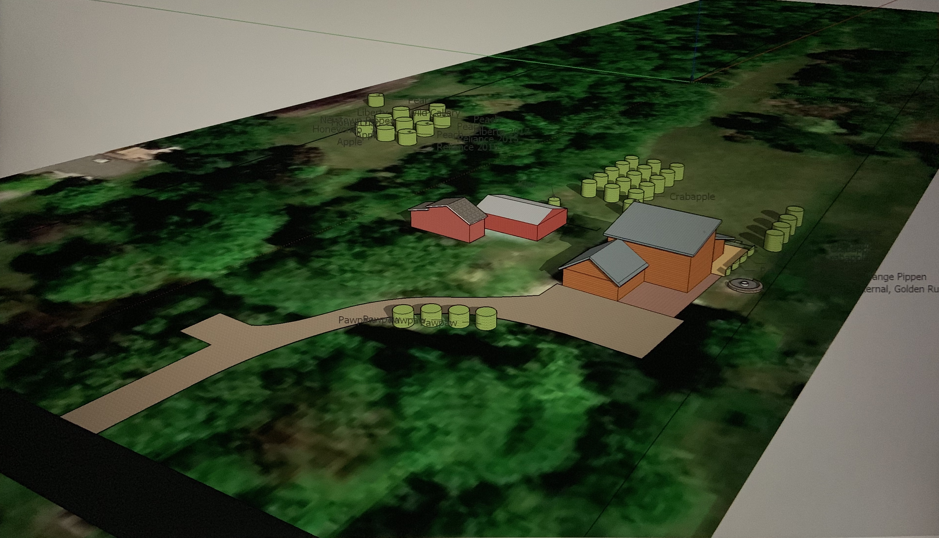
Here’s what I’ve done so far. I’m trying to get the buildings and hardscape done before I get too wild with the plantings. They actually have a pretty good catalog of objects that you can import in to your model and save a lot of drawing time. Using the measuring tools and specifying the length of lines lets you get pretty precise with placement.
I second the sketchup suggestion. You can use a google satellite image of your property as a base. Then you can use the image to build your landscape. I designed and built my house off this software, but I keep it much simpler for the landscape.
Here is why sketchup with a google map image is useful. This is an older image of my property. I circled a young orchard. Instead of going out in the field and taking loads of measurements, I just center the curser on the map and drop in a tree. Then I can make the tree as big as I want to see what kind of shade it will throw in 10 years, or check mowing paths. You don’t have to measure your house or driveway, just built up off the image.
@BG1977, if you go this route, you could easily model your yard, then make a model of the garden you are planning and drop it in the the larger landscape. Makes it easy to focus on the details of the space and then see how it fits in with everything else.