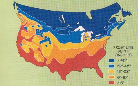
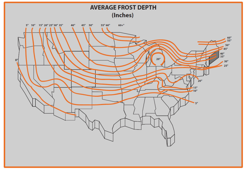
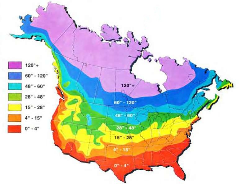
This question has come up a couple times for me recently, both in the context of areas where avocado zone pushing is feasible (only locations where the soil never freezes more than a few inches), and in the context of maypop hardiness (whether the roots need to be below the frost line to survive).
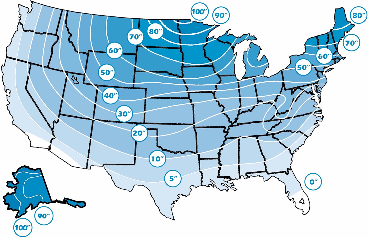
I was trying to find a good/reliable source of maps showing both the average depth and extreme maximum depth of freezing soil in winter, and the various maps I found seemed mostly either very low resolution or very inconsistent with each other, especially here in the PNW. I’m including a bunch of those below, but I’m curious if anyone has a better source (e.g., maybe NOAA or USDA makes a map that doesn’t come to the top of Google hits?).